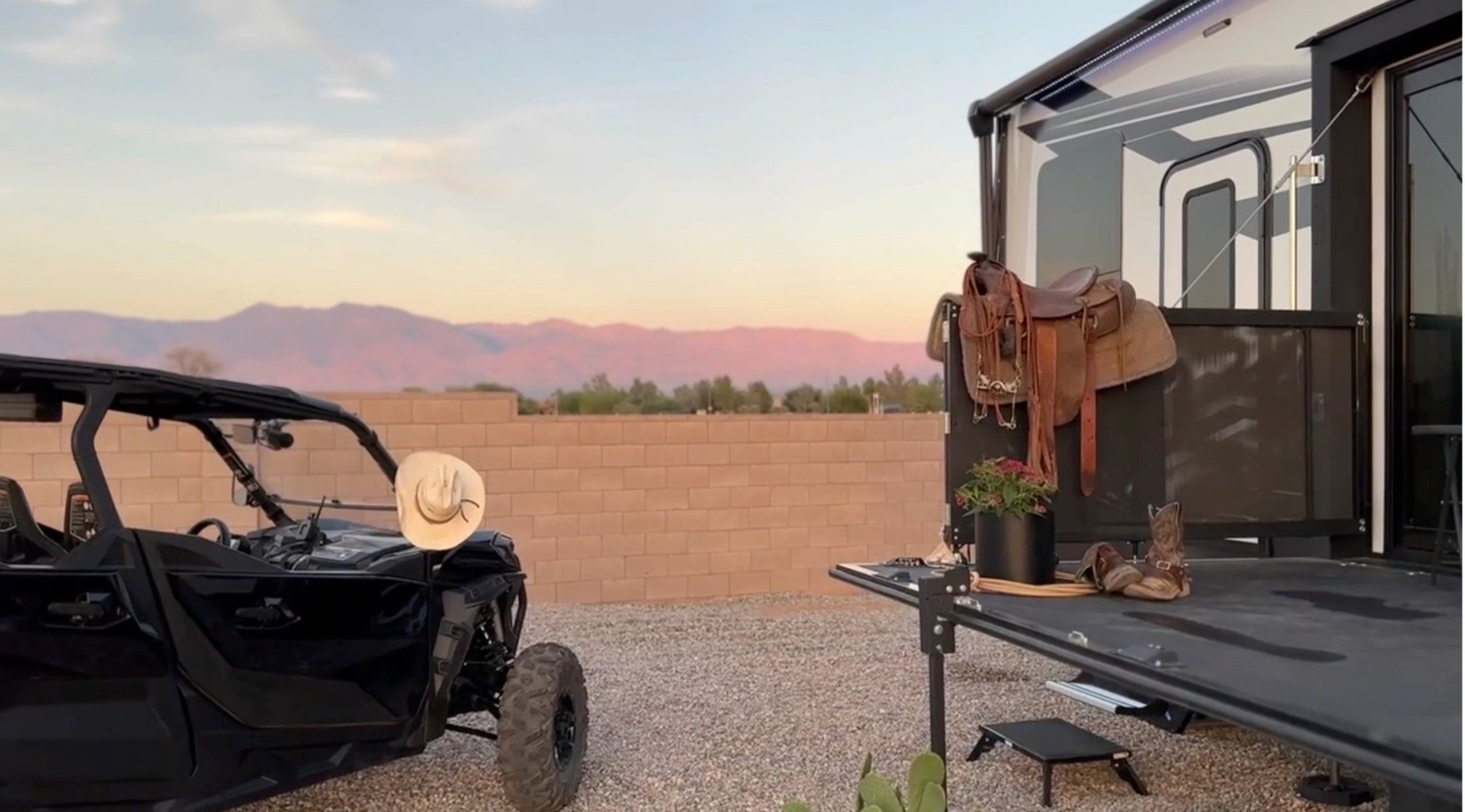
Mesquite Outdoor Rentals Is Our Partner For Your Adventure
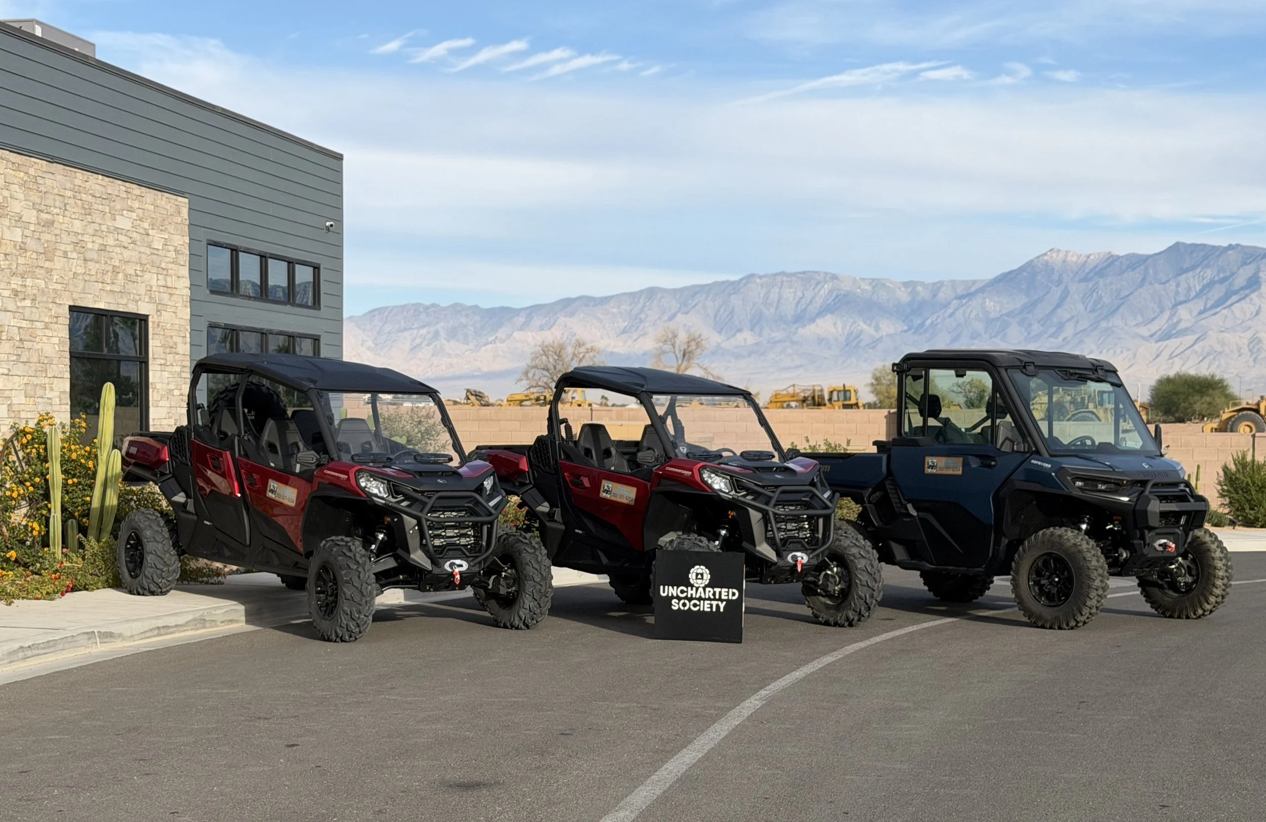
Mesquite Trails RV Resort partners with Mesquite Outdoor Rentals to bring the ultimate off-road experience directly to your stay. No hauling, no trailering—just step out of your RV and jump into a top-tier UTV/Side-by-Side, or hop on an E-Bike, ready to explore the Mesquite area trail system.
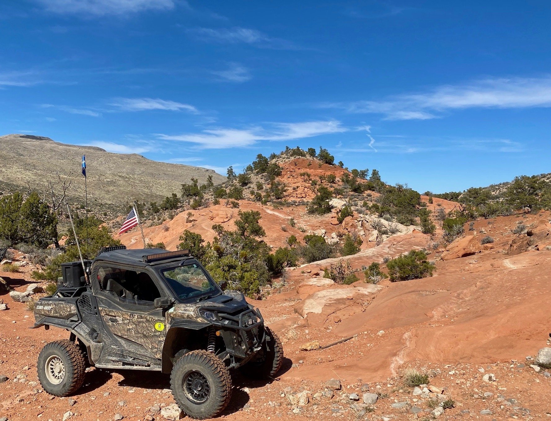
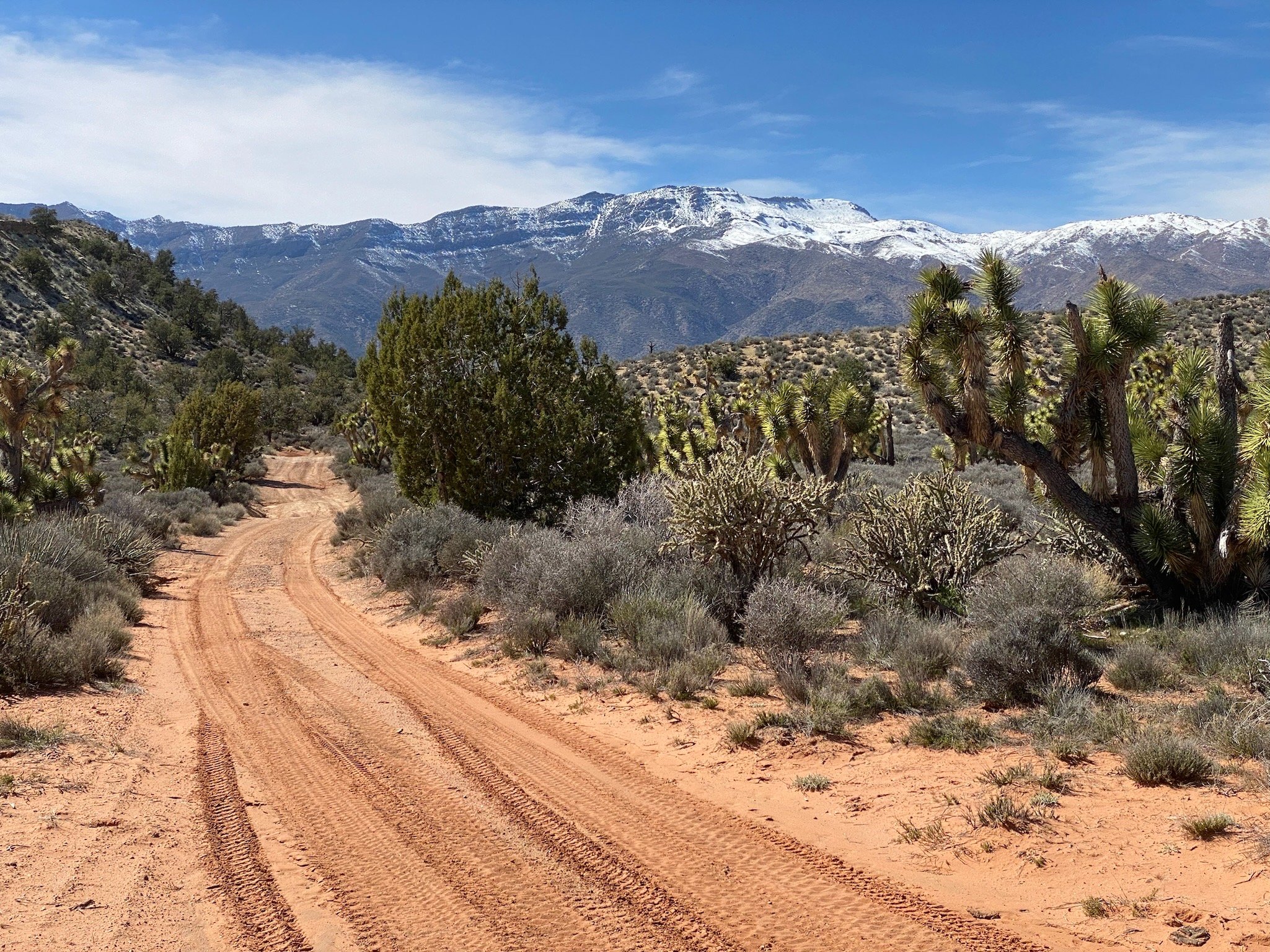
There is so much to explore. The Mesquite, Nevada area is a kaleidoscope of eclectic and stunning landscapes. The terrain is beautifully diverse, marking the dramatic collision of the Basin & Range and Colorado Plateau. The best of both worlds that exist in these geological regions are scattered all throughout the off roading trails surrounding us. Mesquite Outdoor Rentals can help you find them.
The people behind this awesome amenity are the same trusted team of veteran outfitters behind Deadwood Outdoor Rentals and Mystic Gulch Rentals, widely known for their experience in hospitality and premium fleet quality.

We Will Make Your Adventure Easy, Safe, and Unforgettable
Experience the bounty of off-road trails, return, relax, enjoy the luxuries of our resort, and then… do it all over again.
Now premiering Can AM Models…
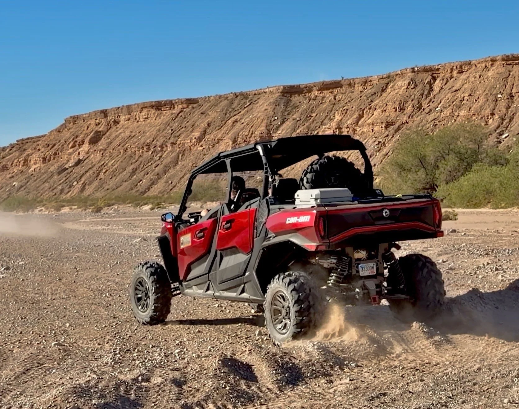
Mesquite Outdoor Rentals are revving up for their second season here with us!
Sporting a heater to keep you warm on those morning rides and an air conditioner to keep you riding through the Mesquite summers, the Defender XT 1000R will be a favorite for sure!
Further, they are are offering E-Bikes for rent!
Ride Right From Your Site: Conveniently located on-site at Mesquite Trails RV Resort, providing the most direct access to the area's best off-road trails. You only have to walk out your RV to start your adventure!
Premium, New Fleet: You have a choice list of the newest UTVs on the market, including the enclosed models with Heat and A/C for maximum comfort on the trail.
E-Bikes Now Available: For a closer-to-nature peddling experience, rent one of their electric bikes to explore local area paths.
Stress-Free Ready-to-Ride: Every rental is equipped to ride legally on the streets of Mesquite with essential safety equipment, gear and navigation tools, including all required trail permits for Nevada and Arizona.
Hospitality Experts: We have a proven track record and years of experience in the resort and rental business, offering the professional service and details that matter to you
Mesquite Outdoor Rentals Will Make Your Adventure Easy, Safe, and Unforgettable


Off Highway Vehicles (OHVs) which are properly equipped and permitted are allowed on ALL city streets in Mesquite, NV for the purpose of accessing off-road trails and adventures. This makes Mesquite Trails RV Resort a very friendly OHV RV Park, compliments of the City of Mesquite. This is a privilege only two cities in Nevada have. Please be safe, responsible, and learn your limitations.
Take a safety course, always be prepared, and know the rules on and off road. Tri-State and municipal regulations apply. You can learn more through the links below:
UTV and Off Road Resources
Trail Route Maps - Google Maps
Here are some frequently traveled trails and favorites in the area. Check Back, we are area adding more! Always be on alert and carefulWe try to keep information up to date but trail conditions can change fast. Alway we alert and use good judgement.
Click the upper right square to enlarge the trails on google maps. Click the camera icons for waypoints and photos. Go here to see our trail map videos.
-
Distance: 40.4 mi Average Speed: 9.5 mph Moving Time: 2 hrs 47 min Average Ride Time: 3.5 - 4.5 hrs Minimum Elevation: 1,556 ft Maximum Elevation: 4,469 ft
-
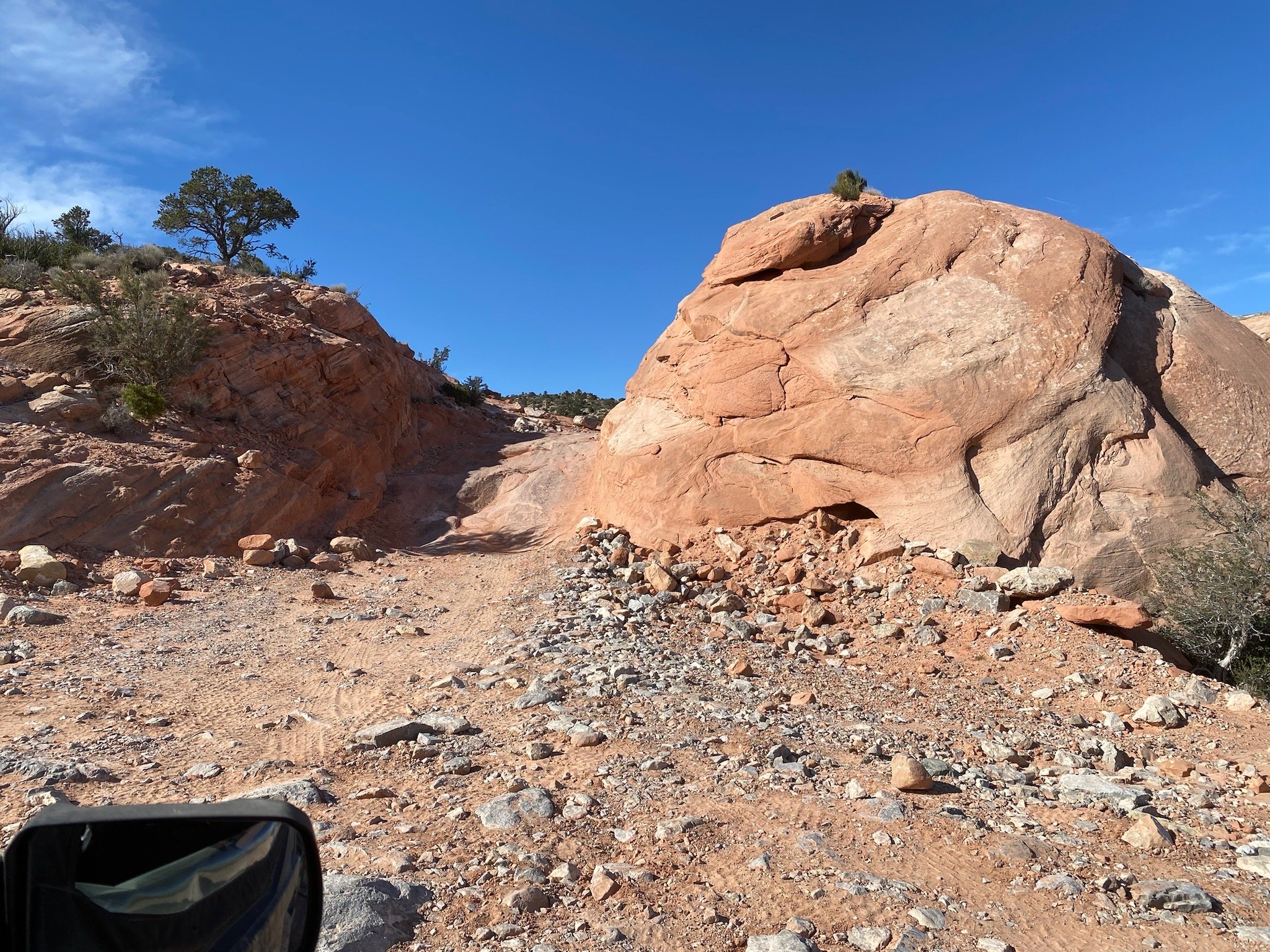
On X Offroad Technical Rating: 3
On X #3 Rating Explained: Uneven, rutted dirt trail with potential for loose rocks and sandy washes. Water crossings less than a foot deep. Potential for mud holes and trail obstacles up to 12”, including ledges and short, steep grades. Roads are typically one vehicle wide with places to pass. On X Offroad
Typically Appropriate For :
High-Clearance, Vehicles, 4x4, SxS (60"), ATV (50"), and Dirt Bikes
-
From Cabin Canyon Road, turn on Hen Springs Road. This road quickly becomes a one-lane trail. As you climb up and around the mountainous terrain, you will be surrounded by the Virgin Mountains. The beauty will surround you, and you will find yourself taking many pictures. Upon arrival at Beer Can Fence, you will find the number of cans hanging on the fence surprising. Rumor has it that the farmers started placing beer cans on the gate to be able to find the fence in the dark; however, visitors have kept up the quirky tradition of hanging more cans along the fence. This is a good stopping point as there is room to pull off the trail. This trail will then tie into Bunkerville Choo Choo Trail.
Comments on Feb 06, 2025:
Trail is open and normal. This has just been recently graded. It has been widened up, so most of it is a lane and a half now. There is even some pull off spots to let someone pass. There are still some wash outs on the lower side that will come back with some rain. Bob Dirocco, On X OffRoad
-
On X Off Road Disclaimer:
The technical ratings listed below provide an idea of what you might encounter on a trail or road. While we made every effort to prepare you for your ride, trail conditions can change quickly and unexpectedly due to weather, closures, new obstacles, and other unforeseen events. Use your best judgment, know what your vehicle can handle and be safe. onX Off road and its affiliates are not responsible for trail ratings, trail conditions, your driving ability or your skill level.
-
Distance: 61 mi Average Speed: 18 mph Moving Time: 3 hrs 25 min Average Ride Time: 4 - 5 hrs Minimum Elevation: 1,556 ft Maximum Elevation: 2562 ft
-
On X Offroad Technical Rating: 2
On X #2 Rating Explained:
Some Washed out areas, deeper ruts . Majority of the trail is a 1, not for highway AWD vehicles. Narrow and possible scratched by sagebrush. Deeper sand common in this area.
Typically Appropriate For :
High-Clearance, Vehicles, 4x4, SxS (60"), ATV (50"), and Dirt Bikes
-
From Cabin Canyon Road, turn on Hen Springs Road. This road quickly becomes a one-lane trail. As you climb up and around the mountainous terrain, you will be surrounded by the Virgin Mountains. The beauty will surround you, and you will find yourself taking many pictures. Upon arrival at Beer Can Fence, you will find the number of cans hanging on the fence surprising. Rumor has it that the farmers started placing beer cans on the gate to be able to find the fence in the dark; however, visitors have kept up the quirky tradition of hanging more cans along the fence. This is a good stopping point as there is room to pull off the trail. This trail will then tie into Bunkerville Choo Choo Trail.
On X Off-road Trail Overview :
Many have heard of the movie Thelma and Louise. Come see the jump site and some surrounding additions to the adjacent fence. This is a fun, easy trail that can be added to a visit to the Three Corners Monument or Cedar Pockets Sink Hole. There are also lots of other things to see, including some beautiful Joshua tree forested areas. You can also go down into the Beaver Dam Wash during the correct times of the year. Do not go into this wash when there is snow melt or forecasted thunderstorms anywhere in this region. Rain falling far away from this site can come down the wash with incredible force.
Comments on Jun 26, 2025:
Trail is open. What else can you say, it was a fun pit stop and the kids laughed so hard they couldn’t talk when they saw all the underwear on the fence.
Nate Sandall, On X Off-road -
On X Off Road Disclaimer:
The technical ratings listed below provide an idea of what you might encounter on a trail or road. While we made every effort to prepare you for your ride, trail conditions can change quickly and unexpectedly due to weather, closures, new obstacles, and other unforeseen events. Use your best judgment, know what your vehicle can handle and be safe. onX Off road and its affiliates are not responsible for trail ratings, trail conditions, your driving ability or your skill level.
Trail Map Videos and Trail Slide Shows
Here dynamic map videos with points of interest as well a photographic tours of the frequently traveled trails above. Again, check back, we are adding more. Also check our your tube channel.
Beer Can Fence Trail Route + Nickel Falls Spur
-
Nickel Falls: A beautiful runoff wash against a rock face
Seeps: Narrow slot-canyon-like seep/spring. Look for interesting lava and rocks splattered on the walls.
Gun-Sight Rock: This peculiar formation gives you the sense of peering directly down a rifle barrel. The narrow gap framed by towering canyon walls creates a natural window that perfectly aligns your view, making
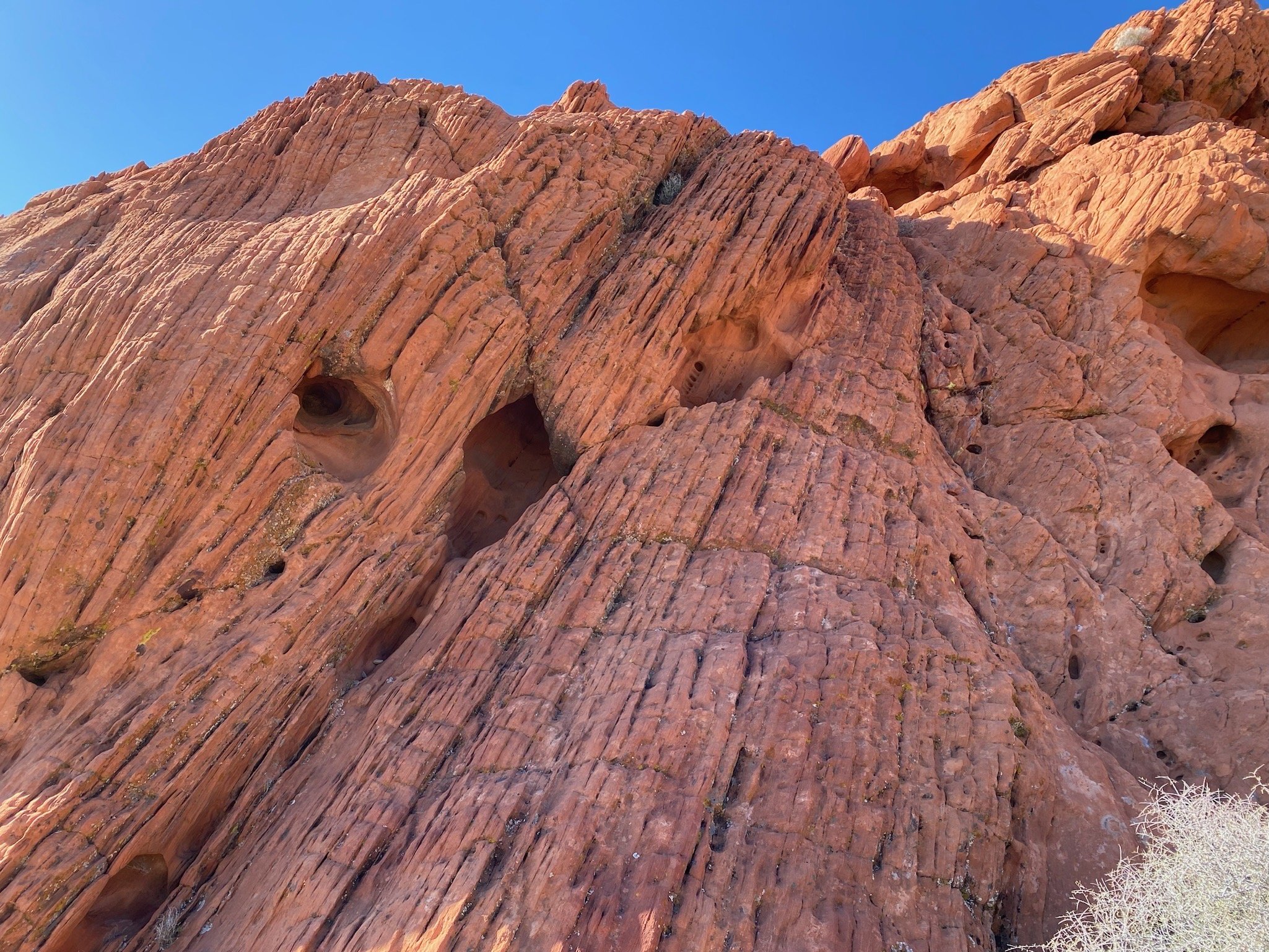
Knife Blades: A canyon in the foothills that showcases the talent of erosion. Geological formations of soft sedimentary layers erode away leaving harder layers that stand up as thin, sharp fins, creating a skyline that looks like a serrated knife.
A Joshua Tree Forest : Located in the beautiful little valley at the base of Pucker Hill.
"Pucker’ Hill: A challenging but rewarding hill named for the first-timer's reaction, offering incredible views of the Gun-Sight.
The Key Hole: A block fault ridge with a cave like hole offering an open view of the Virgin Valley.
The Choo Choo: View the remains of a locomotive brought to this resting place to hold water for cattle.
Views: Take in grand views of Mormon Mesa, Flat Top, the Virgin Valley and the Gun-Sight from various vantage points
-
Experience the incredible biodiversity as you ascend through three distinct zones:
Lower Trails Mojave Desert Scrub: Creosote Bush, Sagebrush, Saltbush, Yucca, and Cholla Cactus.
Mid-Slopes Transition Zone: Black brush, Barrel Cactus, Beavertail Cactus, Mojave Yucca, and the iconic Joshua Tree.
High Ridges Woodlands: Pinyon Pine, Juniper, and Utah Agave, providing more shade and cooler air. This is more indicative oof the ridge above Beer Can where the where Americas Tower is located. Stay tuned for this route to be published.
-
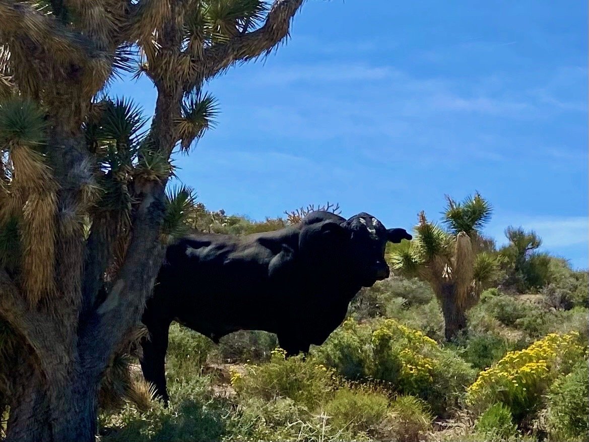
Wildlife: Watch for Jackrabbits, Roadrunners, Quail, and Lizards. Watch the road for possible sighting o the endangered Desert Tortoises. Please do not pick them up or disturb them
Thelma and Louise and Cedar Pockets Sink Hole
-
Thelma and Louise: unofficial, colorful, and rebellious monument created by the local off-roading community celebrating the adventurous, "take-no-prisoners" spirit of Thelma & Louise. This funny attraction is located on an old fence draped with a collection of bras and undergarments. The fence ends at the mesa edge with a gate that opens to air.… Many real memorials of beloved off roaders who have passed also have been erected along the rim.
Cedar Pocket Sink Hole: Is a very large hole. caused by the collapse of the overlying strata layer and dissolution of underlying soluble rock. depression. It is pretty cool.
Route: is on the Northwest side of I15, the Basin and Range. The are washes characterized by loose sand and rocky stream beds. You’ll cross over the cap rocks of the mesas formed by the more resistant layers of strata. The trail crosses the alternate highway to St. George (not the gorge).
Views: sweeping, scenic vista overlooking the desert landscape of the Beaver Dam Wash below.
-
Experience the resilient and striking biodiversity of the Mojave Desert as your route traverses sandy washes, climbs rocky spurs, and crosses elevated plateaus.
Wash & Lower Valley Floor (Beaver Dam Wash): This is the heart of the lower desert. Look for Creosote Bush , Saltbush, hardy grasses, Yucca , Cholla Cactus .
Mesa Tops & Ridges (Thelma & Louise Fence Area): As the trail gains elevation onto the mesas, the soil becomes rockier. The vegetation is characterized by tough, drought-resistant species like Black-brush , Mormon Tea, and Barrel Cactus.
Unique Features (Cedar Pocket Sinkhole Area): featuring larger pockets of Beavertail Cactus and some seasonal wildflowers.
-
Wildlife: Watch for Jackrabbits, Quail and Lizards. Watch the trail for possible sightings of the endangered Desert Tortoises. Please do not pick them up of disturb them